
al-Nabi Houri النبي هوري

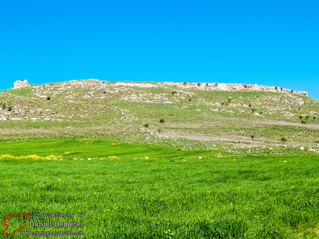
Perhaps the most expansive of the Roman and Byzantine sites in the countryside of Aleppo (حلب) are the remains located at al-Nabi Houri (النبي هوري). Seldom visited due to its remote location, the site contains extensive remains of a once significant ancient city. These remains include an impressive Roman theater and tower tomb as well as two bridges that remain in use today. There are also later Byzantine fortifications and churches. While much of the site is in a poor state of preservation, enough survives to satisfy the amateur archaeologist with several hours of exploration. In the spring, the site is an ideal picnic spot, and a visit could be combined with nearby Midanki Lake.
al-Nabi Houri (النبي هوري) is the classical city of Cyrrhus, founded around 300 BC by Seleucus I Nicator and named after the city in Macedonia. The settlement appears to have been founded as part of a strategy by Seleucus to expand his territorial claims after the death of Alexander the Great. Cyrrhus never developed into a major city under Seleucid rule, largely due to the economic and security challenges posed by the rival Commagene and Armenian kingdoms to the north. The Armenians annexed Cyrrhus in the first century BC, and it was absorbed into the Roman province of Syria following Pompey’s conquest in 64 BC. The city saw subsequent decline due to lawlessness in the region, and did not recover until the following century.
In the first century Cyrrhus was visited by Germanicus, the adopted son of Tiberius, and became an administrative and military headquarters for Roman campaigns against the Armenians to the north. Cyrrhus served as the base for the Roman legion X Fretensis and minted its own coinage. The city became strategically important, located on the secure route connecting Antioch to the Euphrates River crossing at Zeugma (in modern Turkey). Development of Cyrrhus during the Roman period was based on its military and commercial significance rather than the city’s agricultural resources. This importance ultimately declined with the rise of Hierapolis (to the east) in the third century. Cyrrhus was captured by the Sassanid Persians several times during the third century, contributing to this decline.
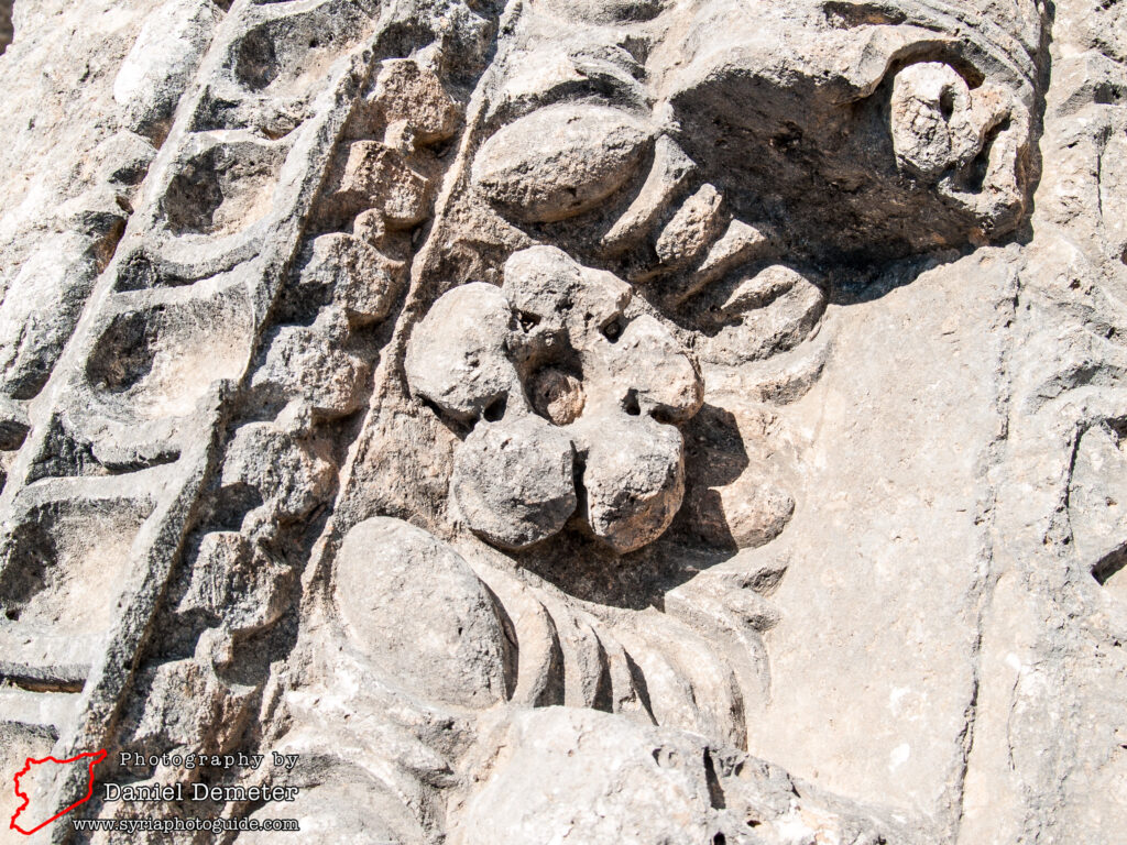
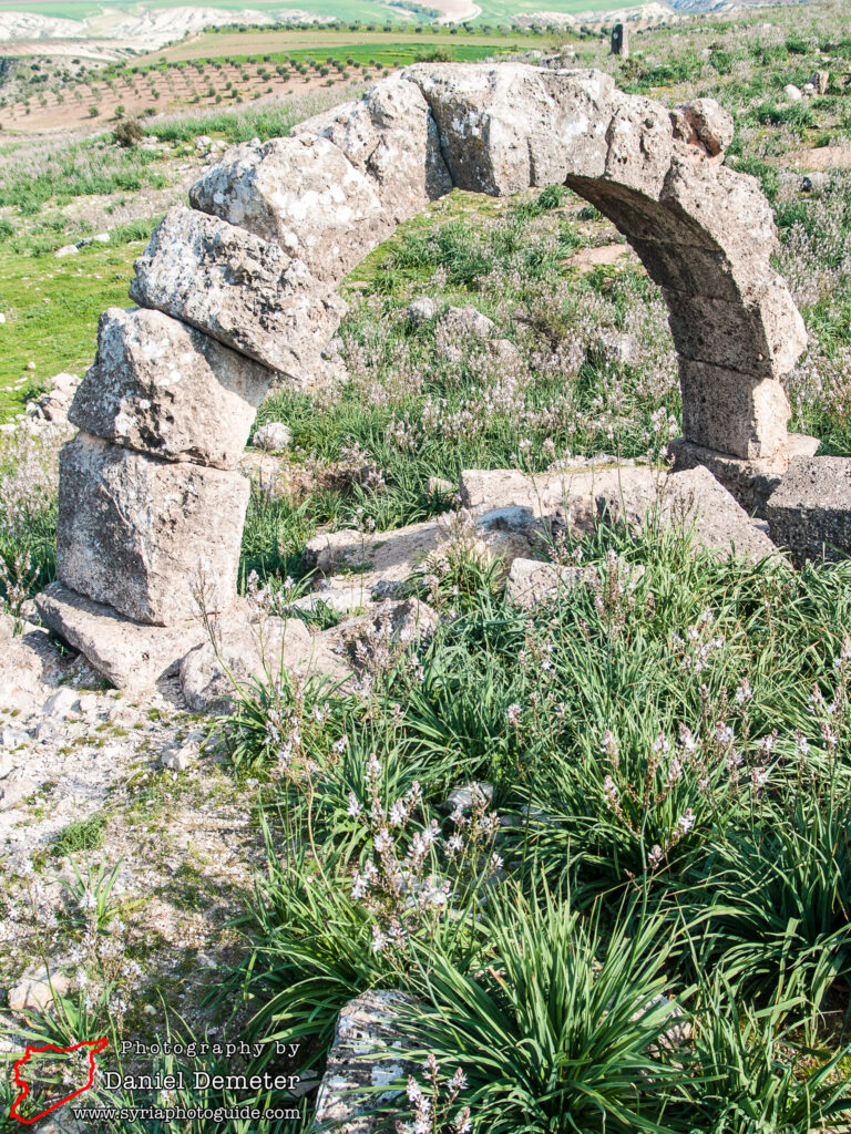
The city recovered during the Byzantine period under the name of Hagiopolis to become a center of some religious importance. The basilica held relics of Saints Cosmas and Damian, who had suffered martyrdom in the area around 283 and were venerated here. The first bishop of Cyrrhus was present at First Council of Nicaea in 325, and eight bishops are known before 536. Theodoret, bishop from 423 to 450, was an influential author and theologian well known for his role in the history of Nestorianism and Eutychianism. His small diocese (about forty miles square) contained 800 churches, which supposes a very dense population. Many holy personages, particularly hermits, had been or were then living in this territory, among them Saints Acepsimas, Zeumatius, Zebinas, Polychronius, Maron (the patron of the Maronite Church), Eusebius, Thalassius, Maris, James the Wonder-worker, and others. Theodoret devoted an entire work to the illustration of their virtues and miracles. In the sixth century the city was fortified and garrisoned by Justinian to secure frontier territories during renewed confrontation with the Persians.
In 637 Cyrrhus fell to conquering Arab armies. The city was held in the early 11th century by the Crusaders and made dependent on Edessa under the name Coricié. Nur al-Din regained control of the city in 1150, and it subsequently lost its strategic importance. The city declined, and Muslim travelers of the 13th and 14th centuries reported it as being a large city that was largely in ruin. The site today is uninhabited, the surrounding area having been developed for olive farming to support the nearby villages.
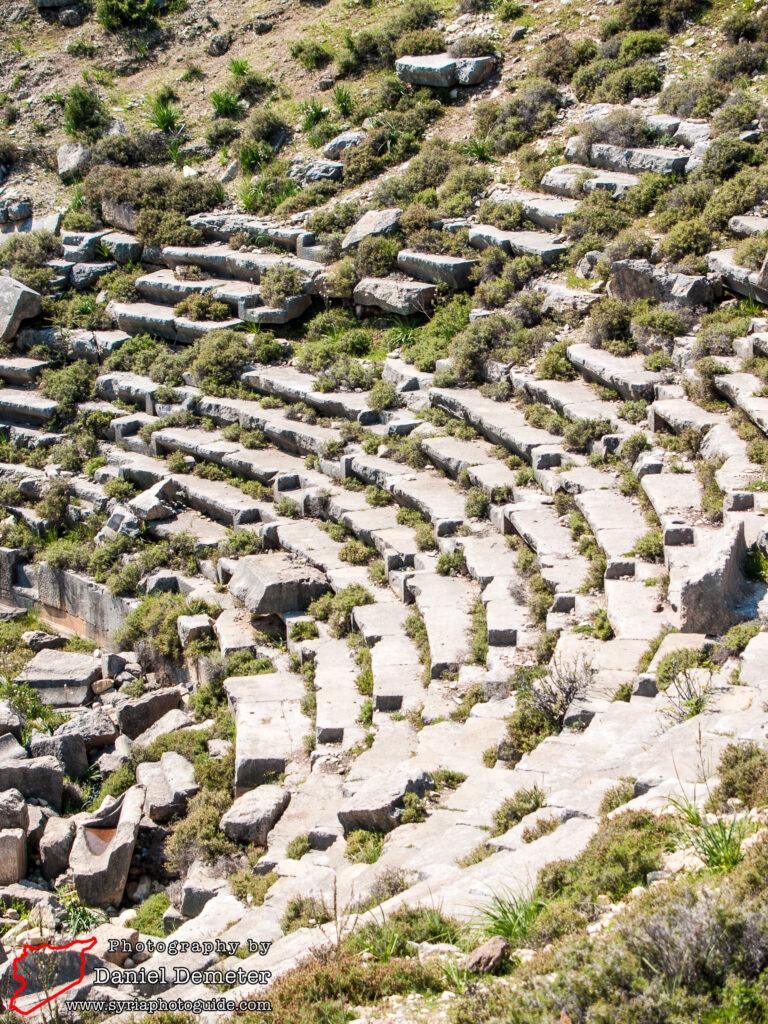
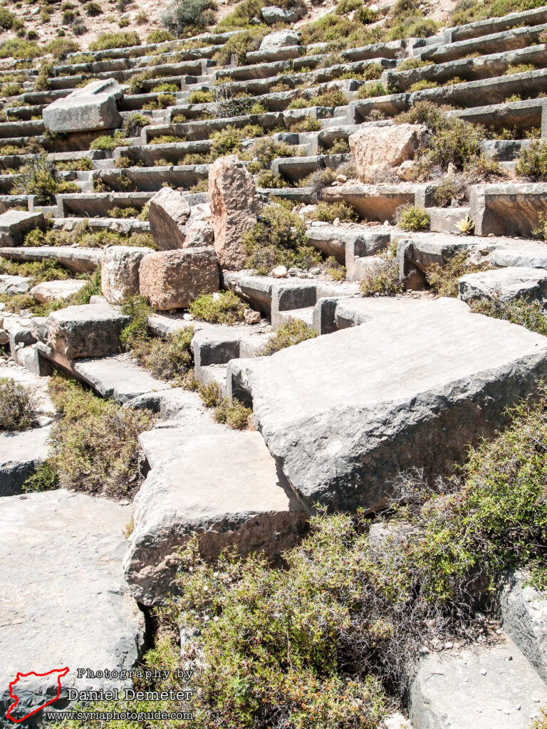
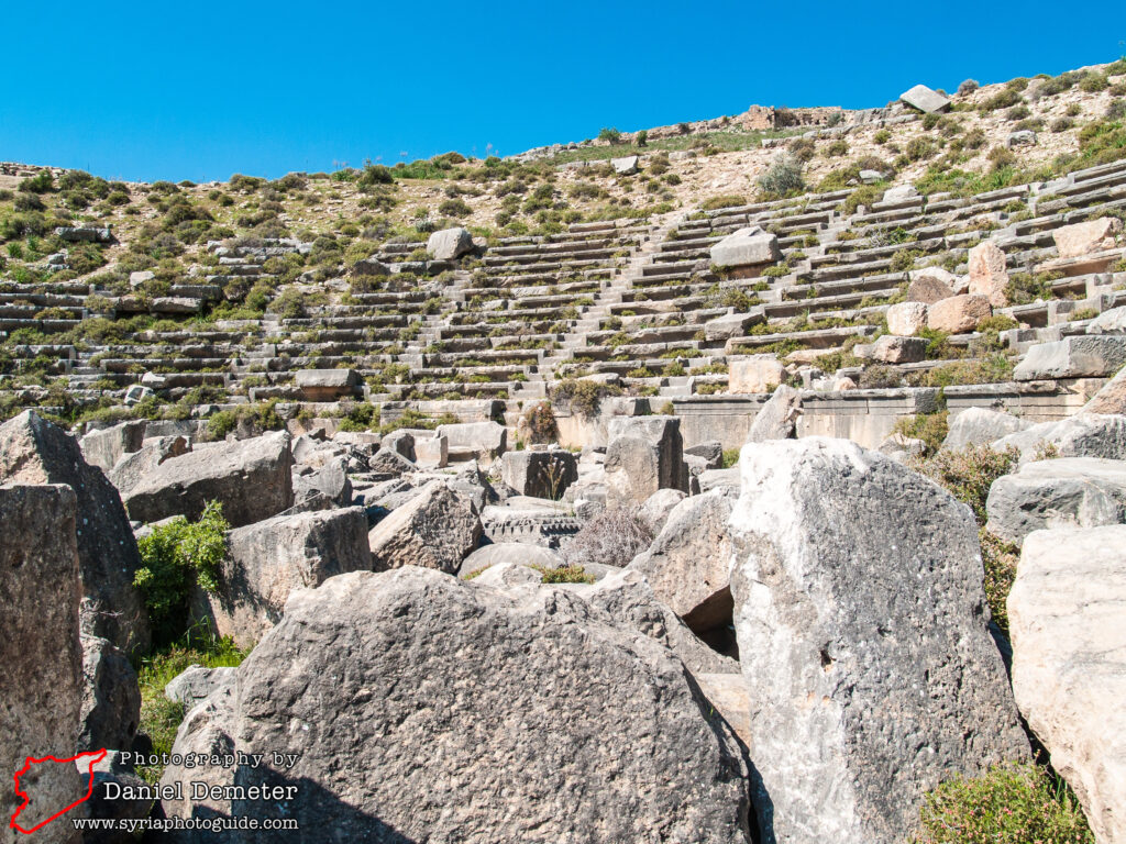
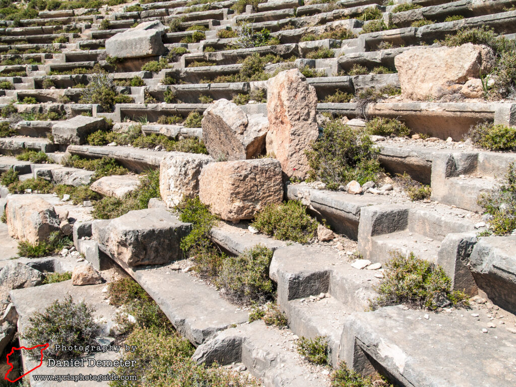
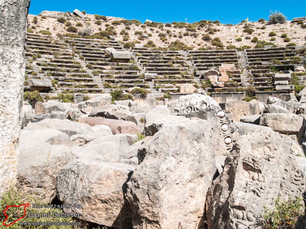
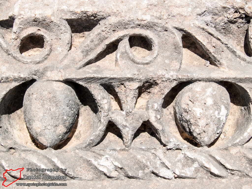
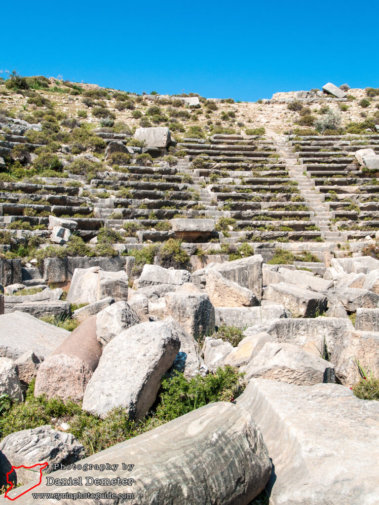
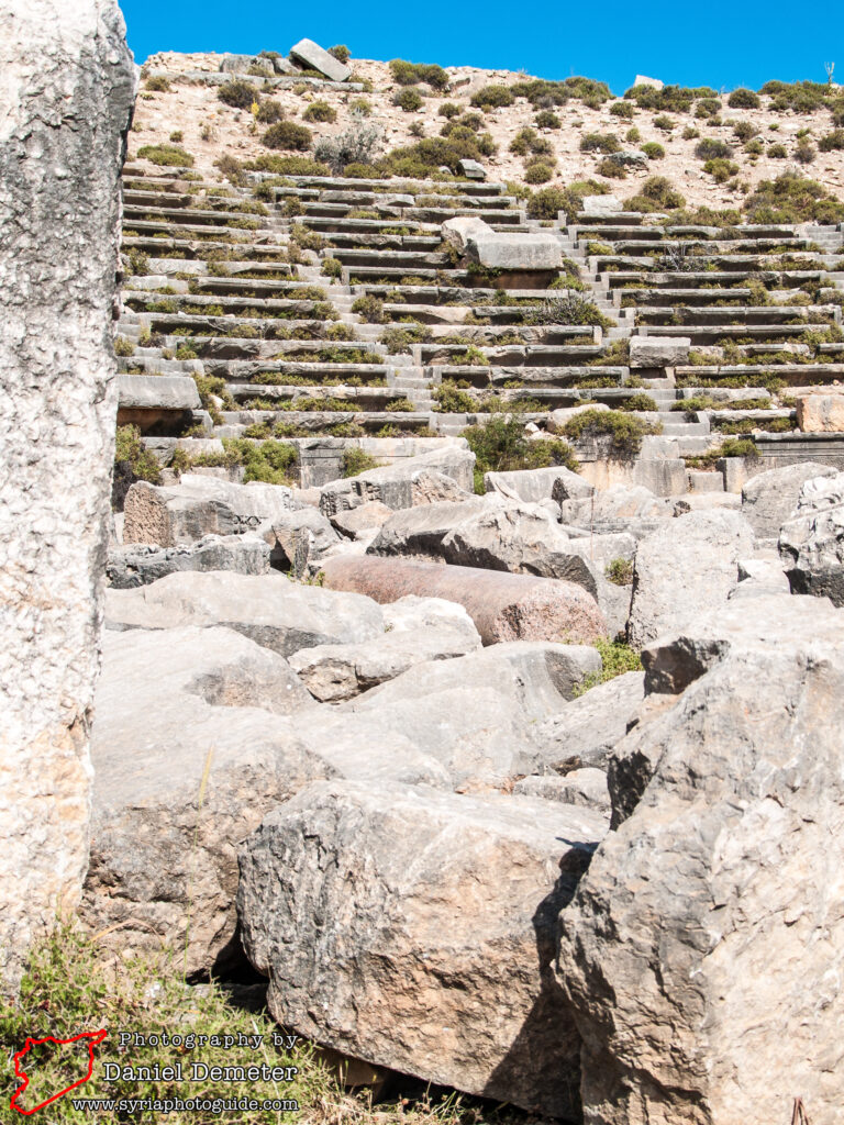
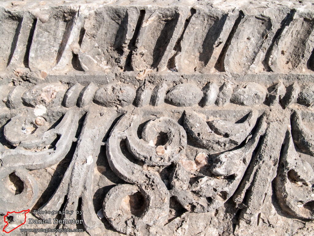
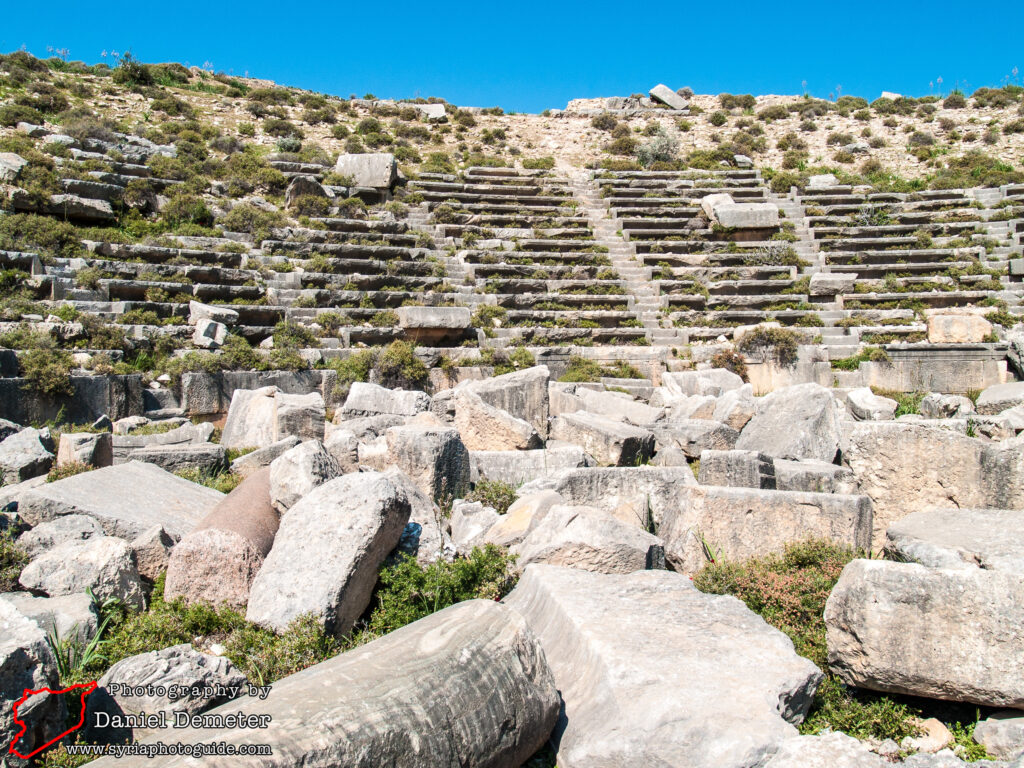
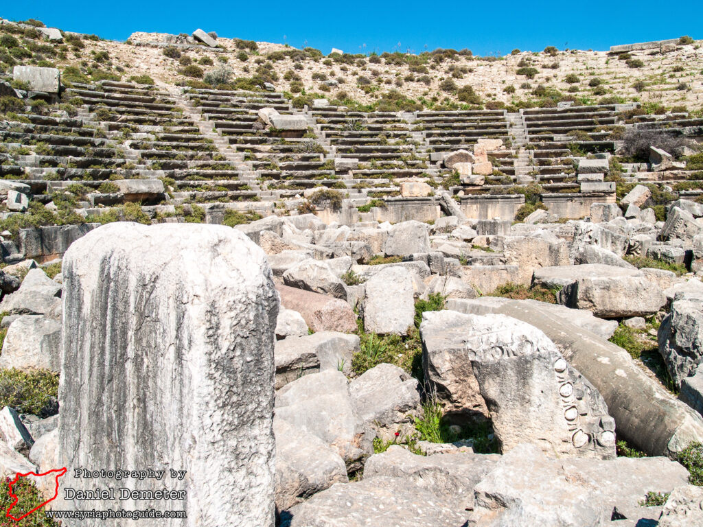
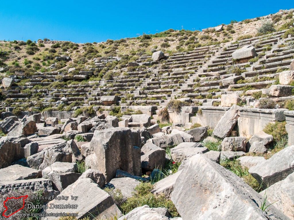
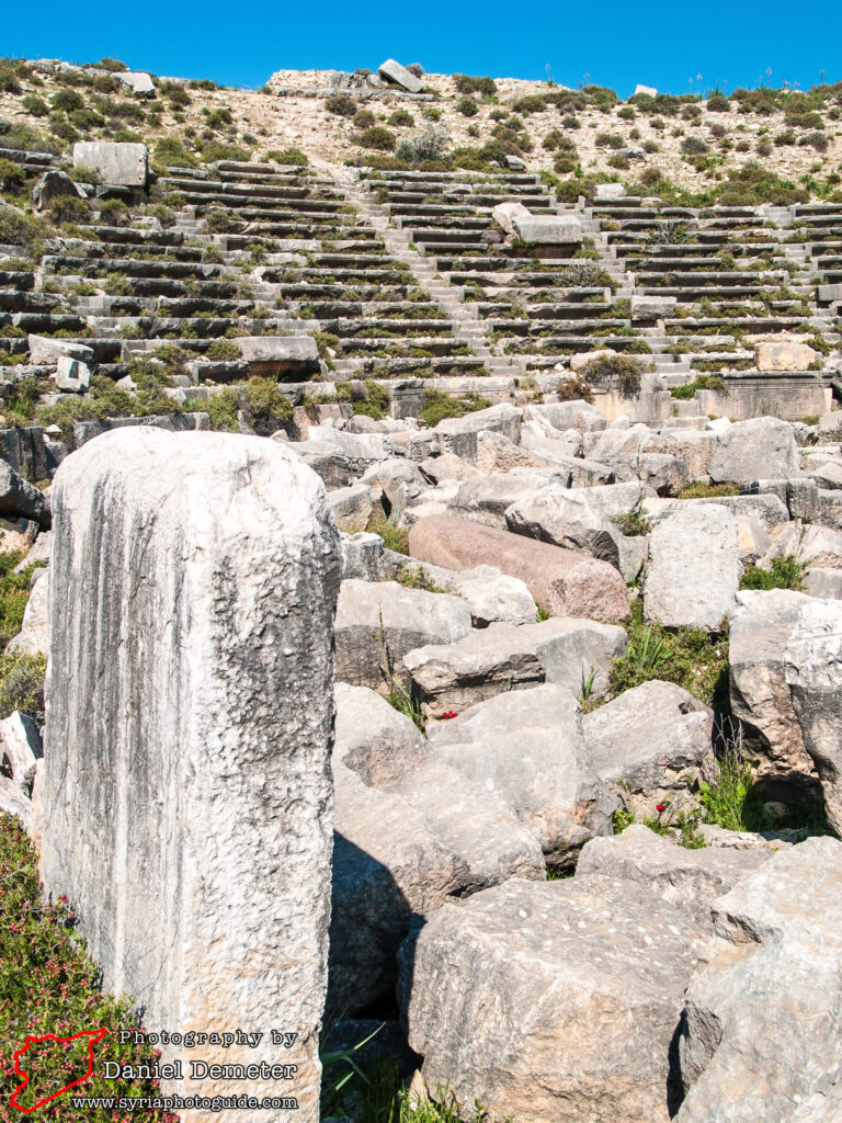
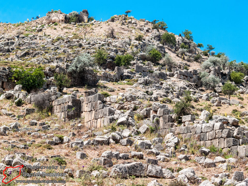
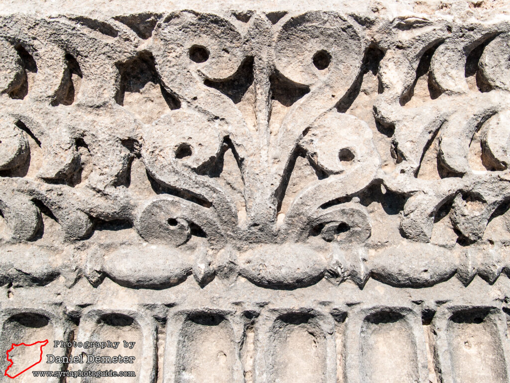
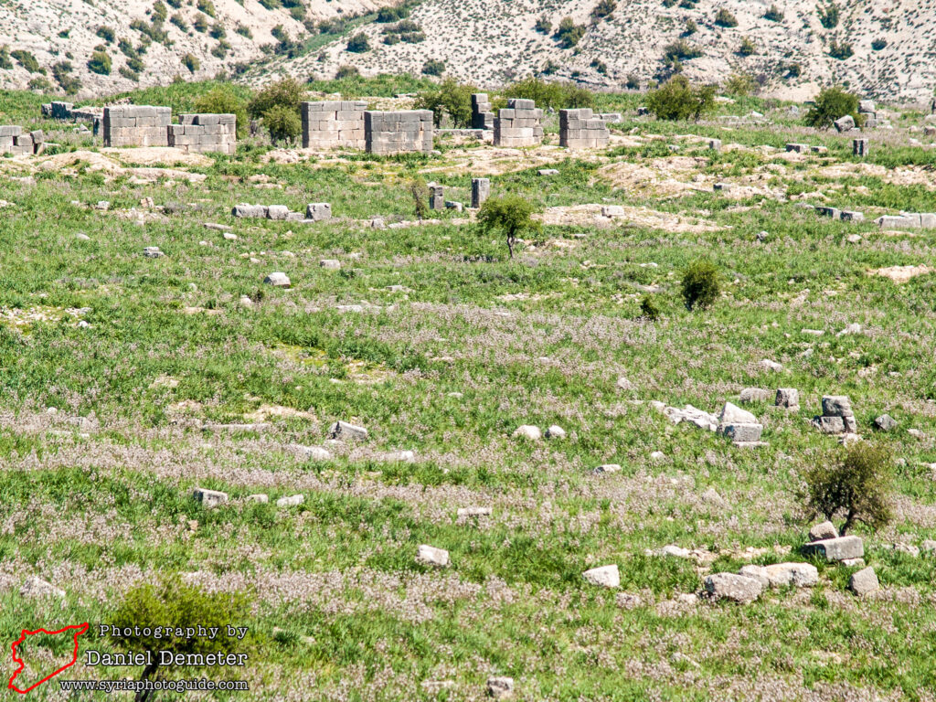
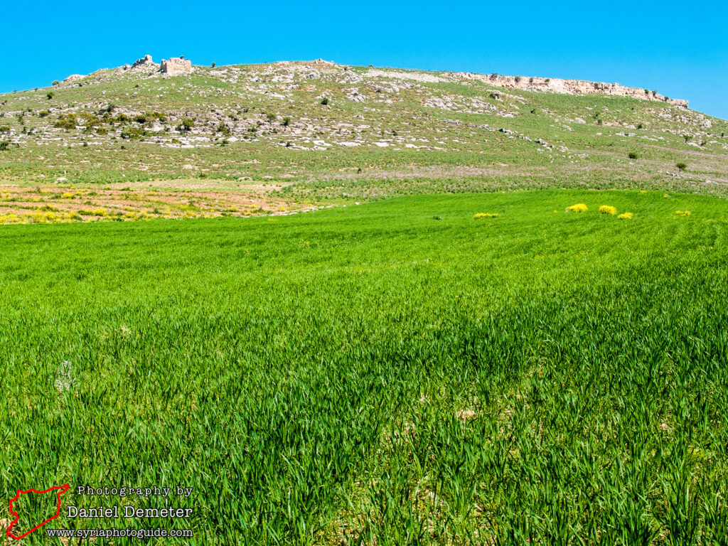
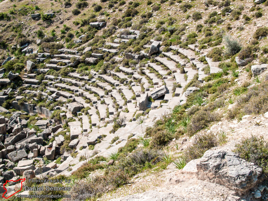
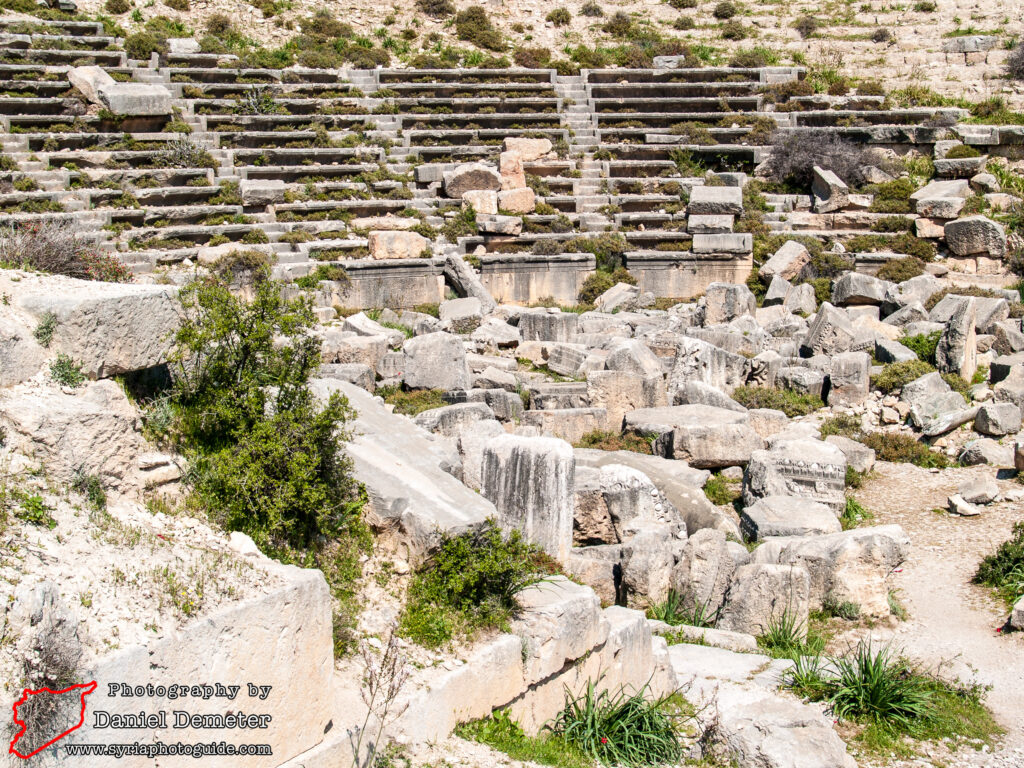
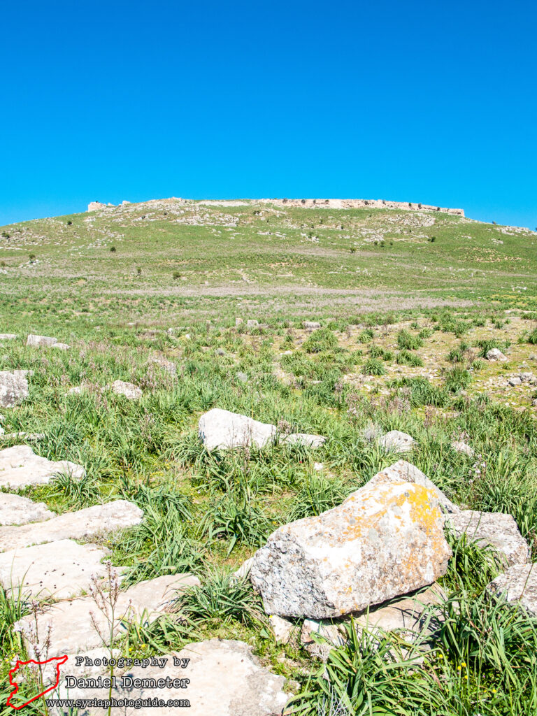
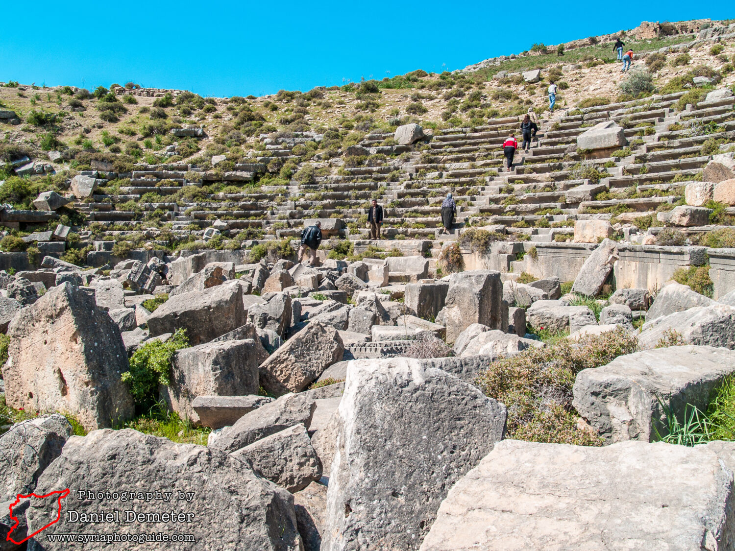
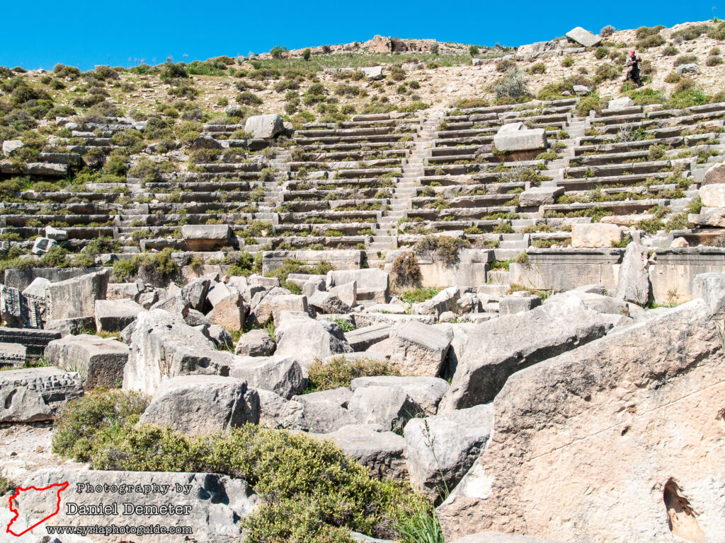
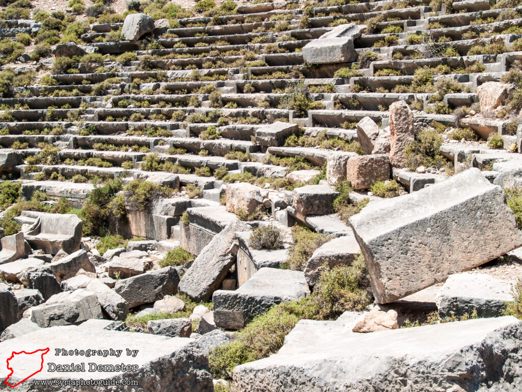
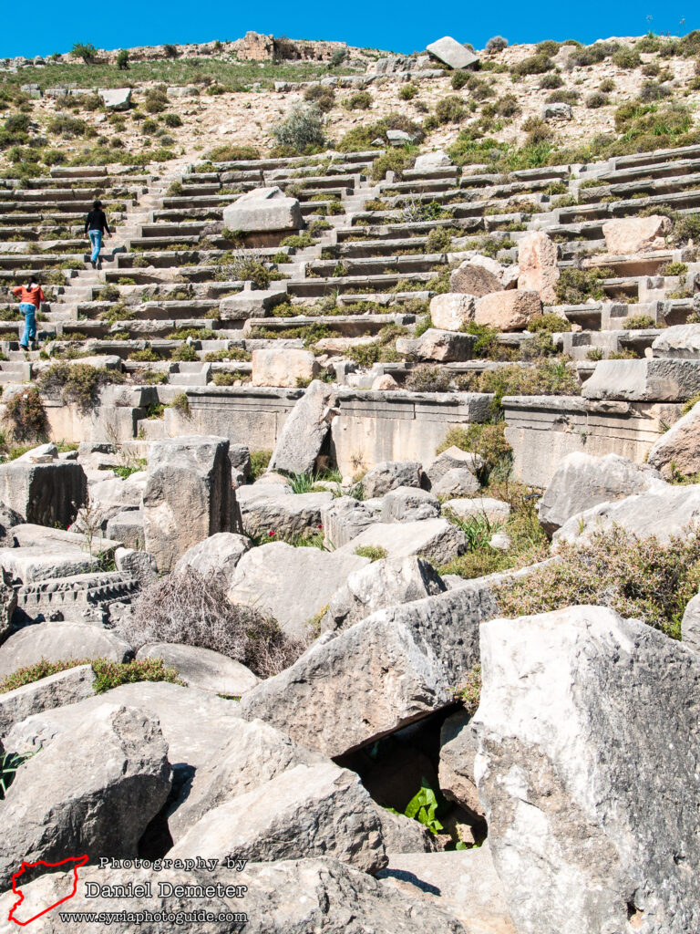
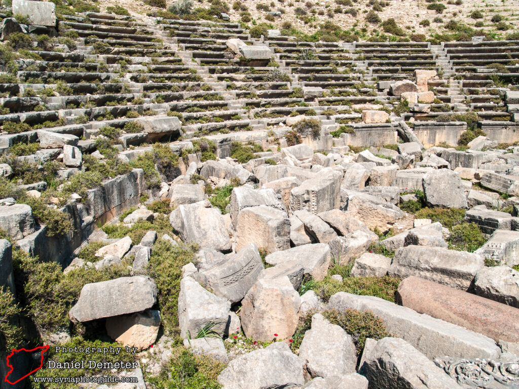
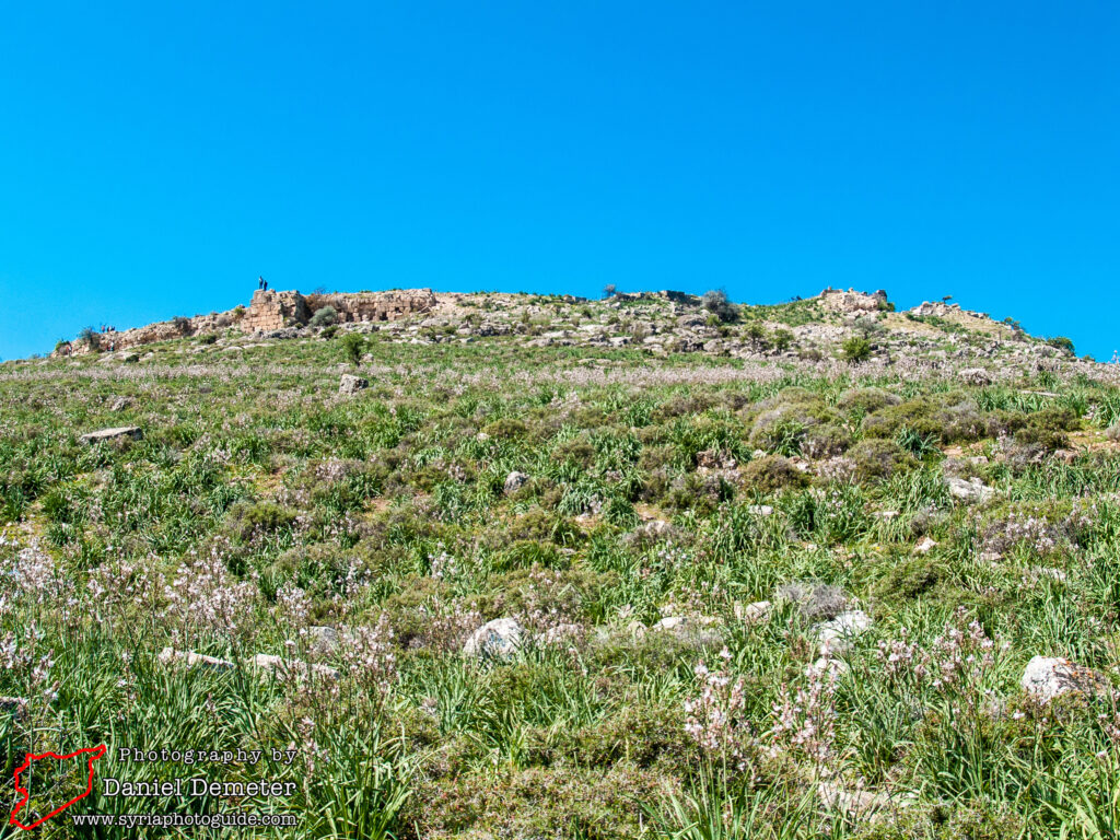
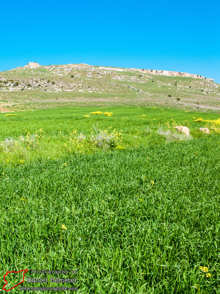
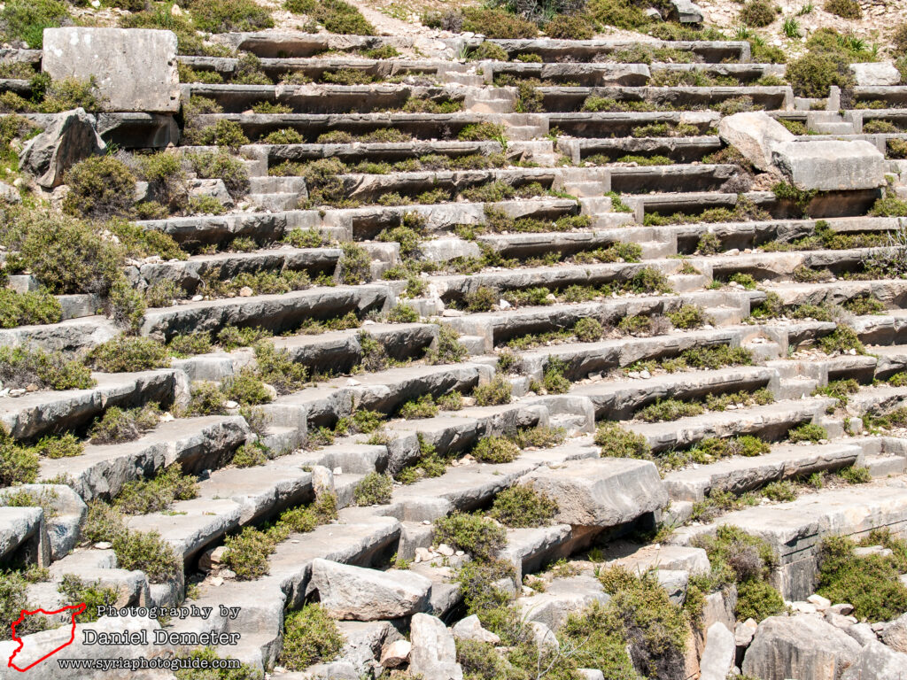
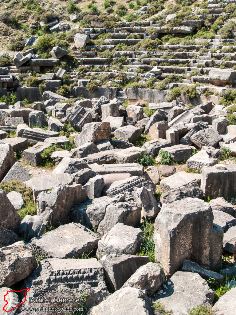
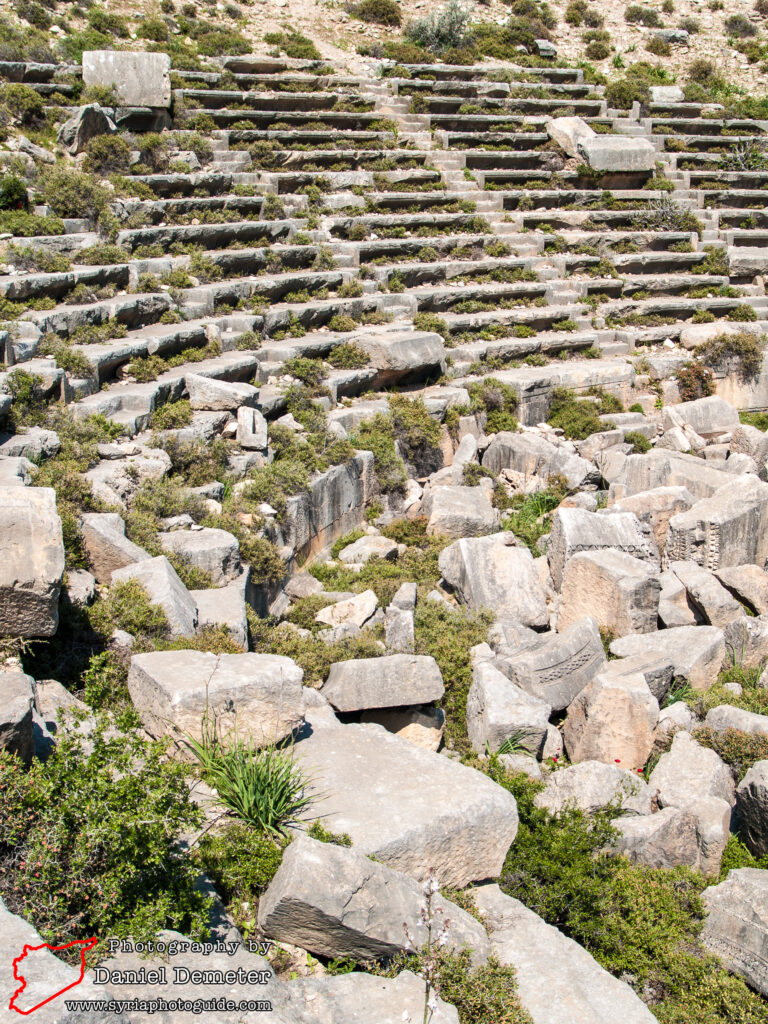
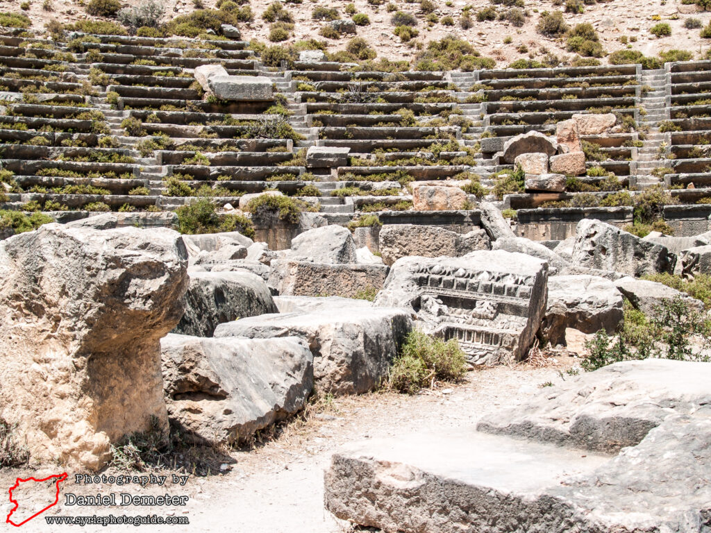
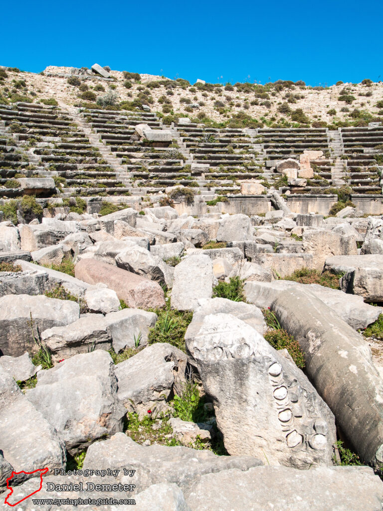
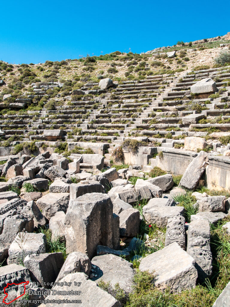
There are only a few monuments which have survived the centuries in decent states of preservation. The most prominent of these monuments is the massive Roman theater, which probably dates from the middle of the second century. With a diameter of 115 meters, the theater was one of the largest in Syria, second only to the theater of Apamea (آفاميا), which had a diameter of 139 meters. This theater was the focus of French reconstruction efforts in the 1950s and 1960s, though they only restored a small portion of the structure that was once larger than the contemporary theater at Bosra (بصری). Earthquakes and centuries of mining for building materials destroyed much of the stage and the free-standing upper section of the theater, while the first eleven rows that were embedded into the earth have been preserved.
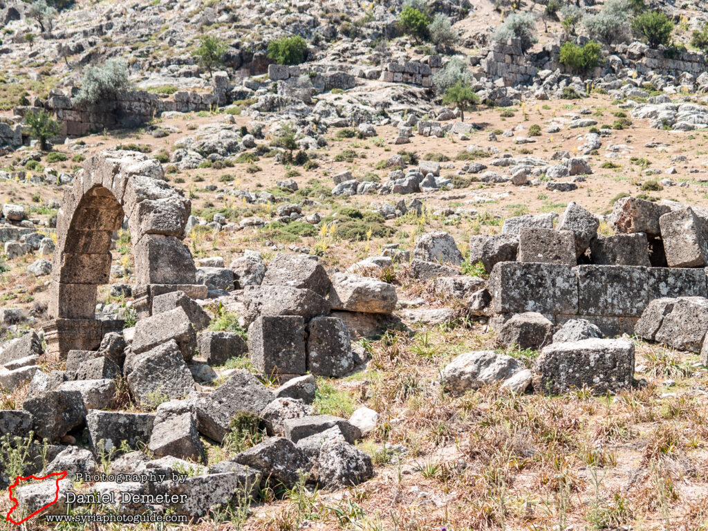
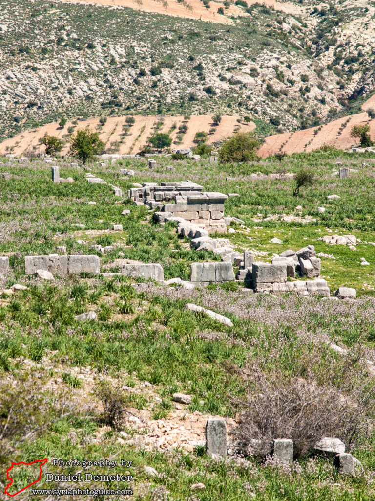
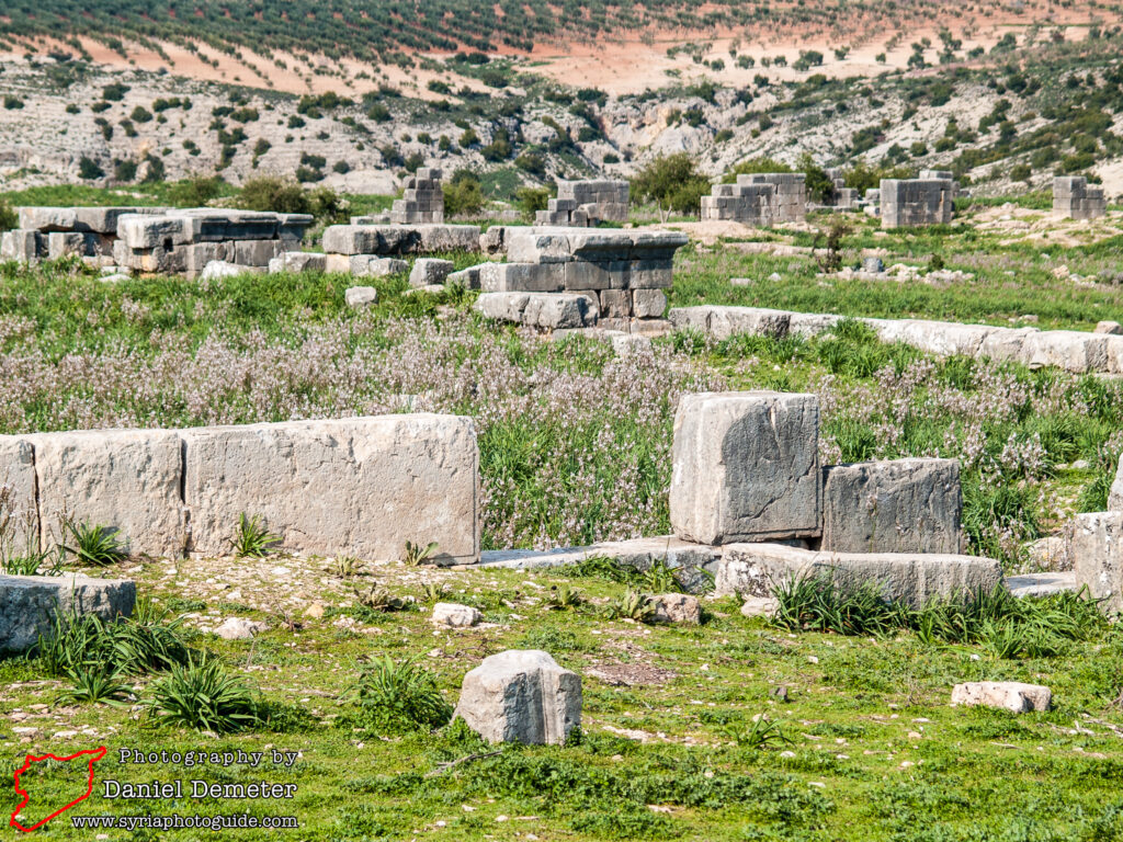
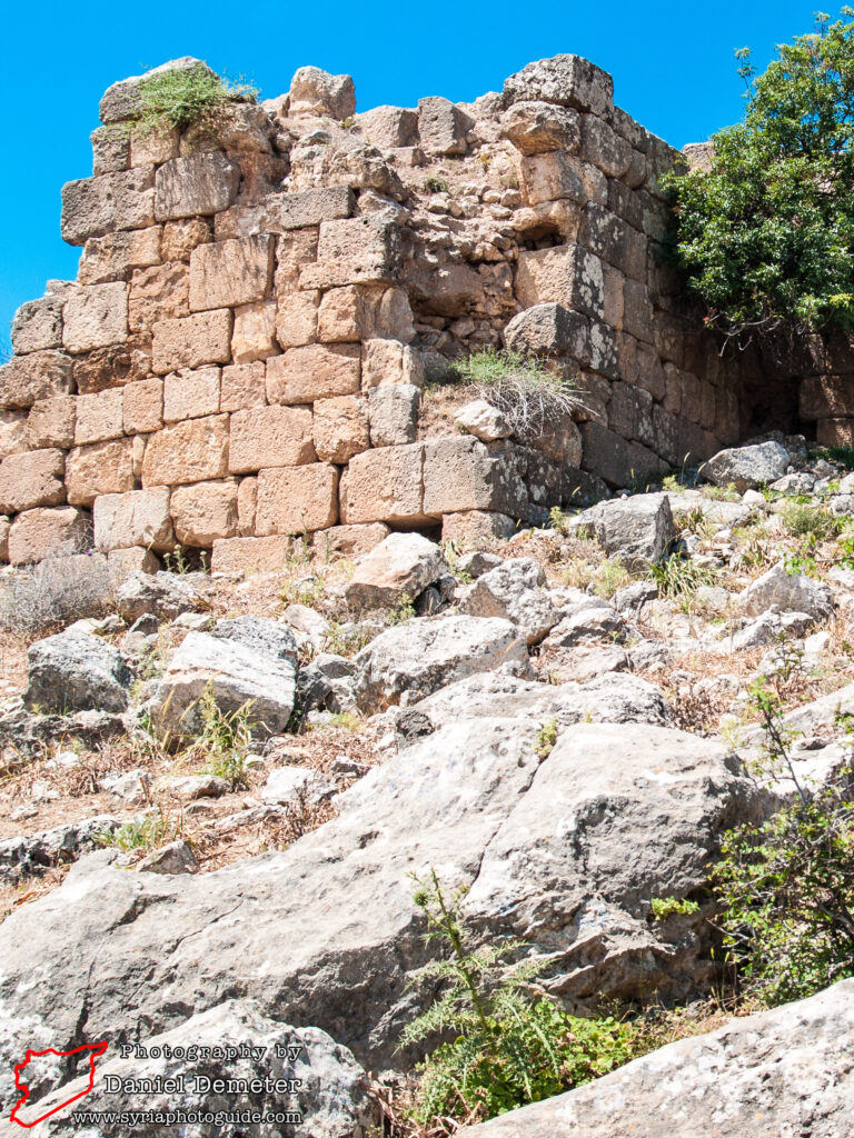
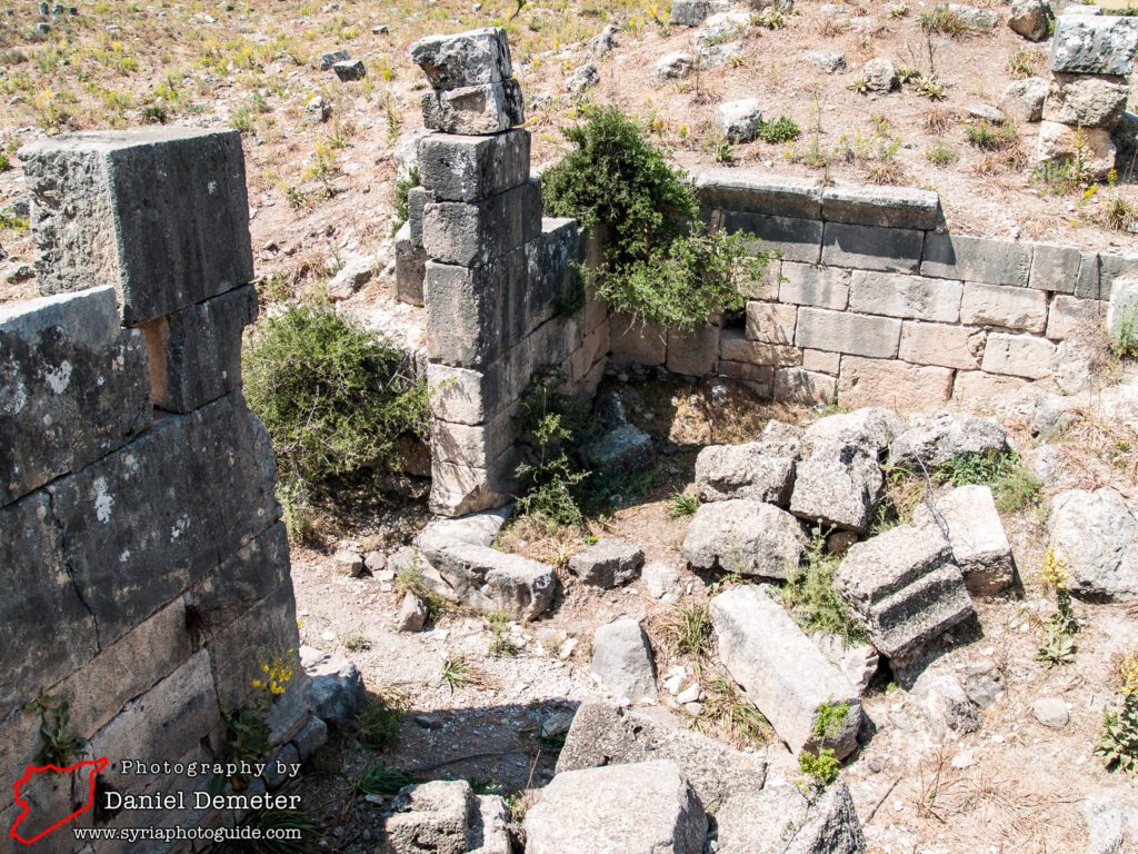
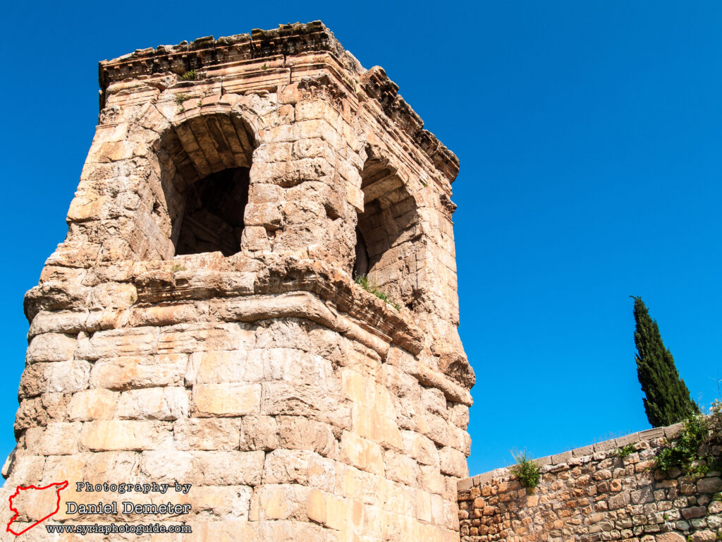
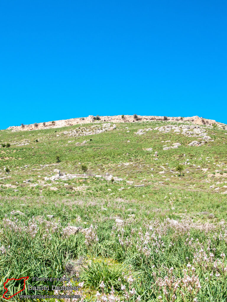
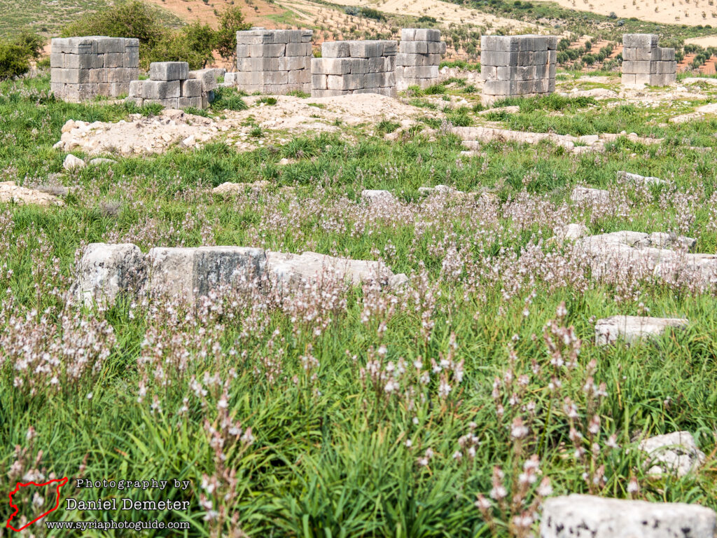
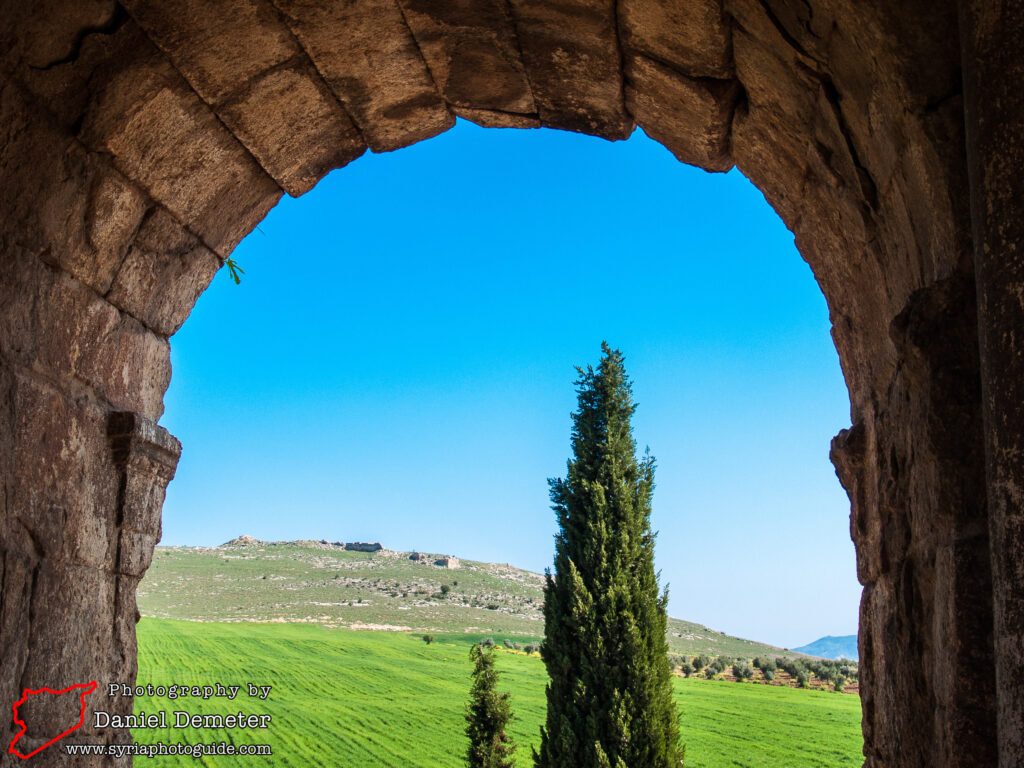
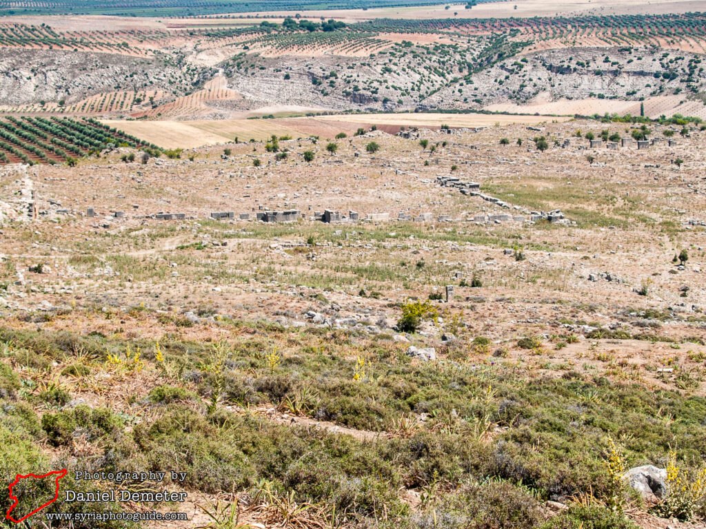
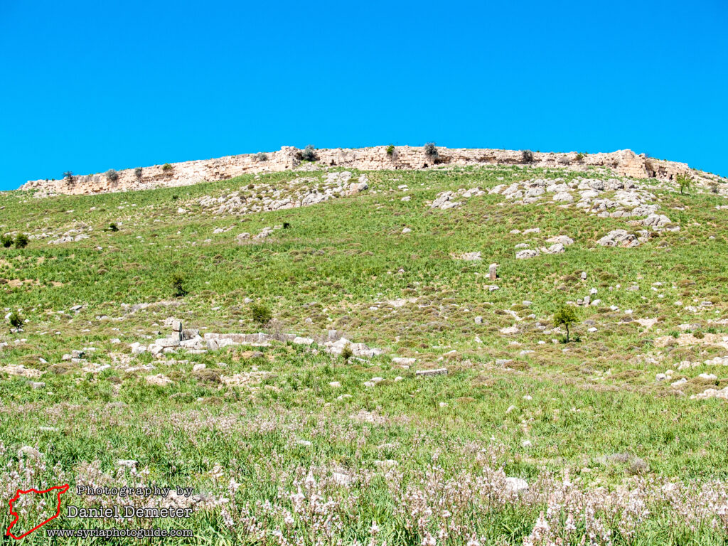
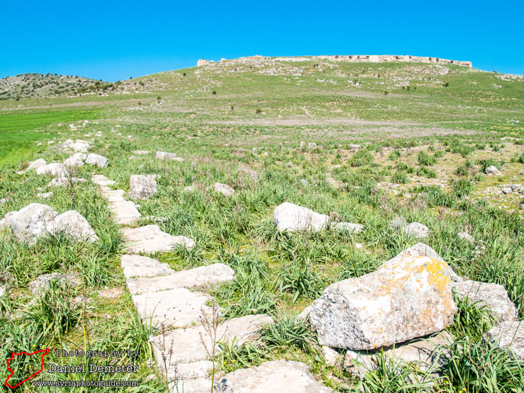
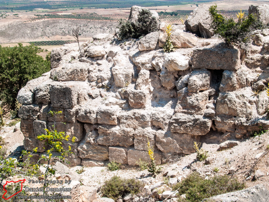
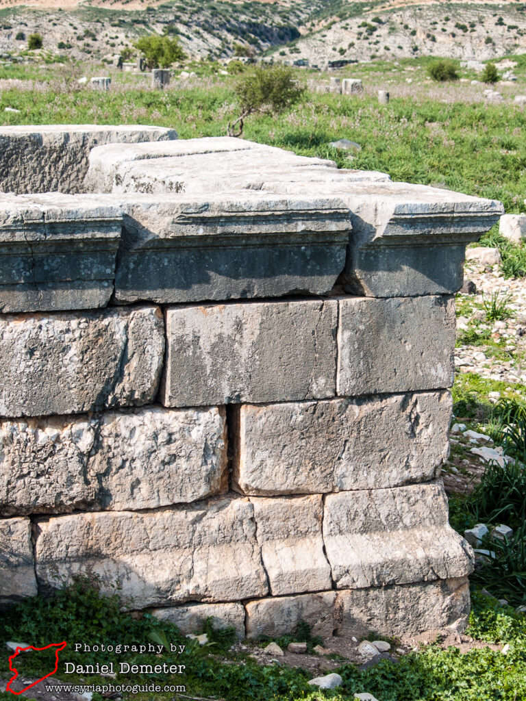
To the west, the large citadel overlooks the theater. An inscription on the entrance gate at the northwest corner confirms that at least the acropolis walls were the work of Justinian. While the fortifications are largely in ruin, the remains allow the visitor to appreciate the large scale of this ancient city. From the top of the citadel hill one is able to trace the ancient city walls and recognize the grid pattern typical of the planned settlements of the period. The colonnaded main street (cardo maximus) ran north-south and was seven meters wide. At the southern end of this street was a monumental gate that formed one of the principal entrances to the city. To the north are the remains of a large enclosed church and a basilica, though little remains beyond the foundation stones.
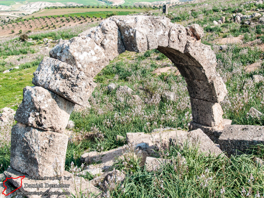
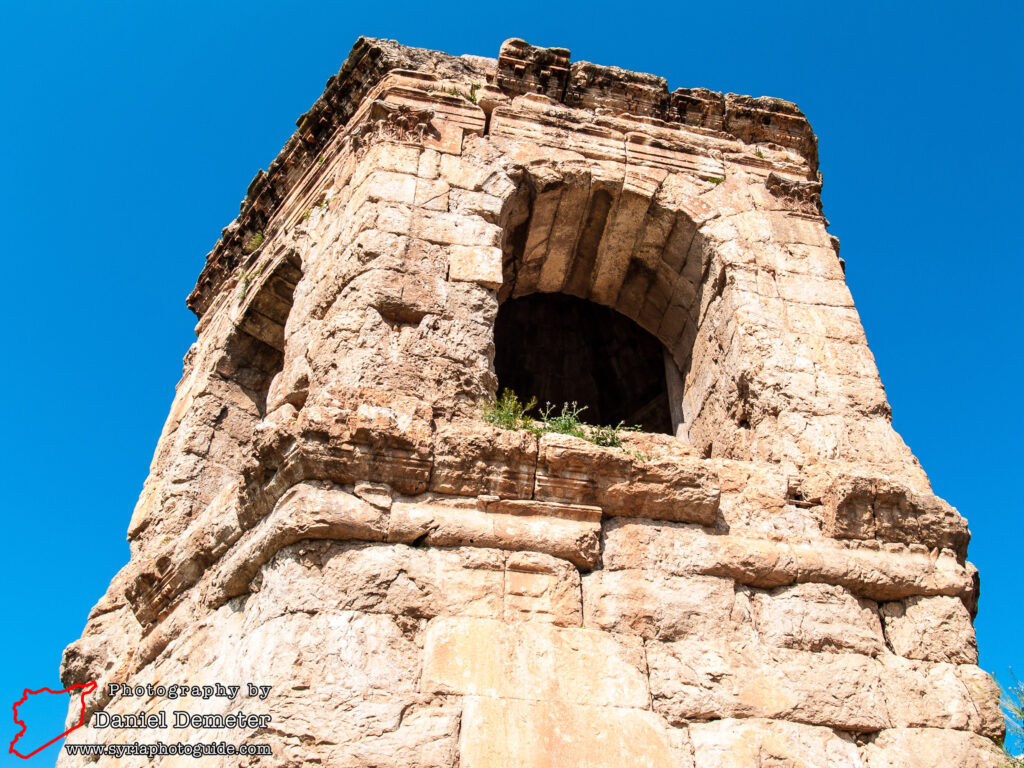
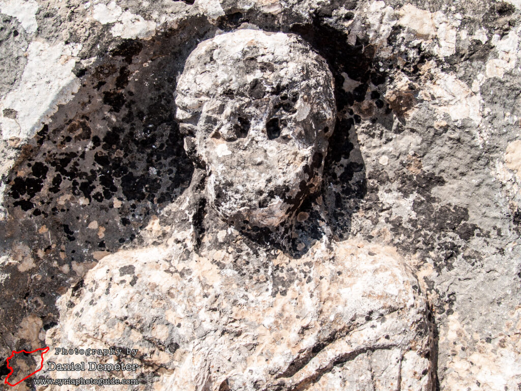
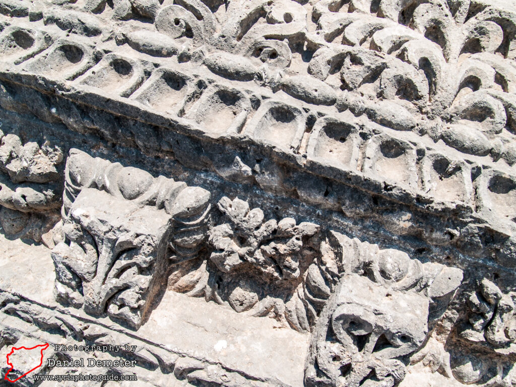
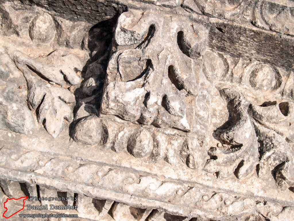
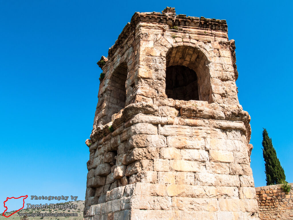
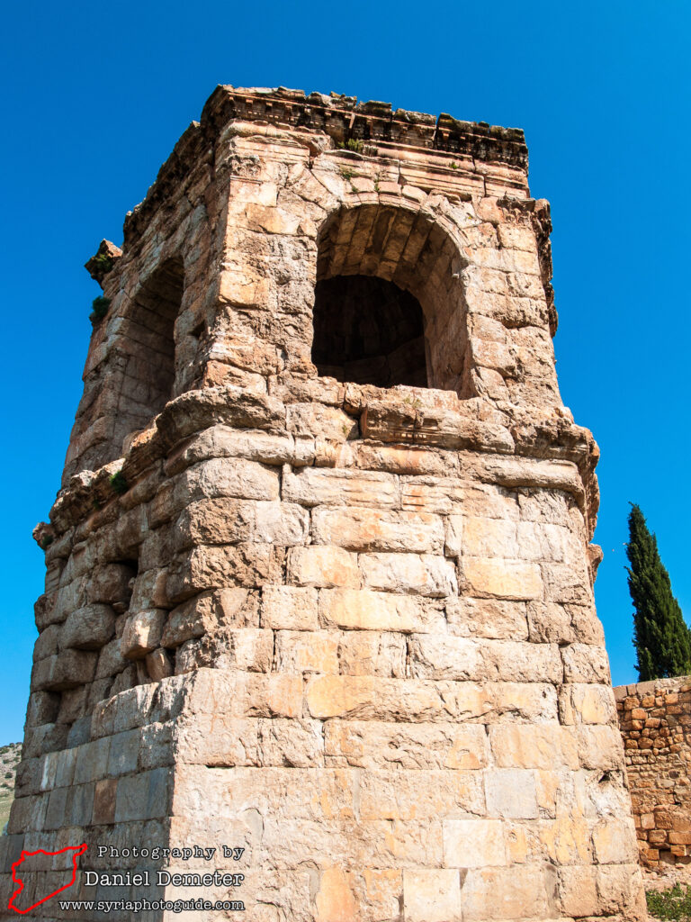
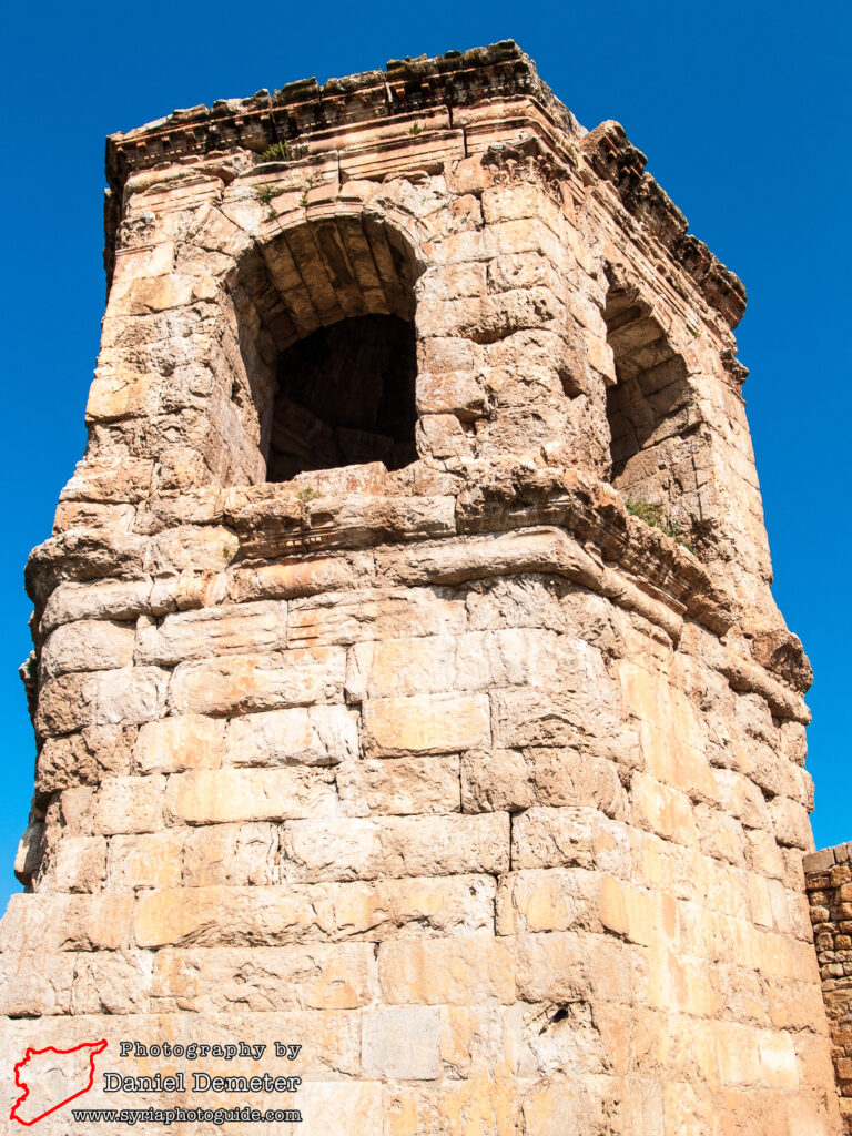
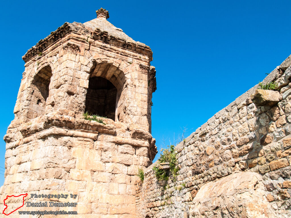
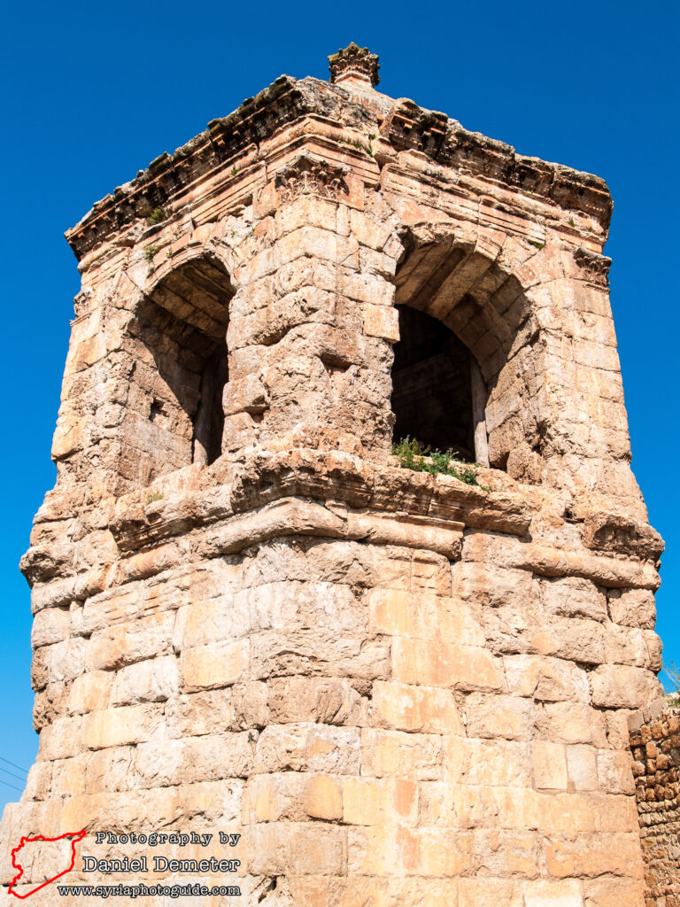
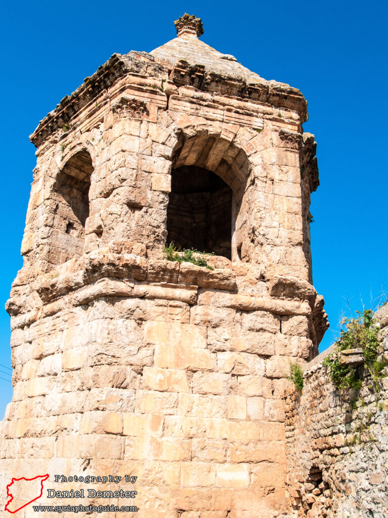
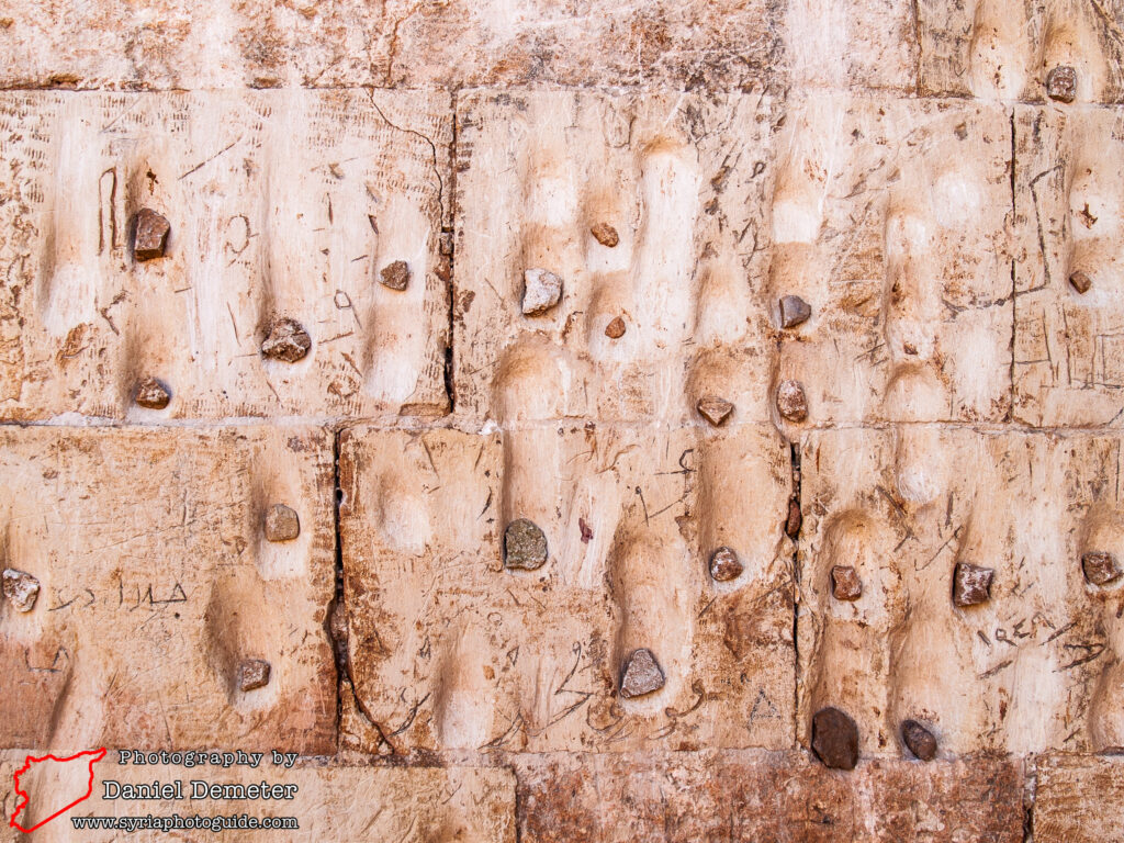
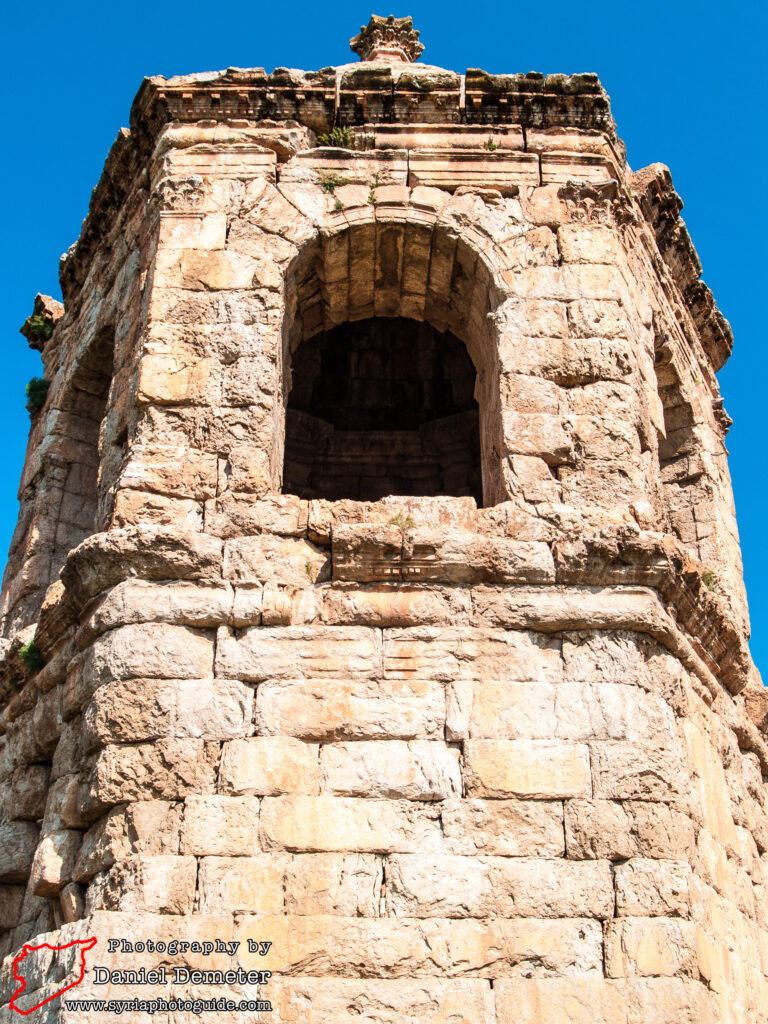
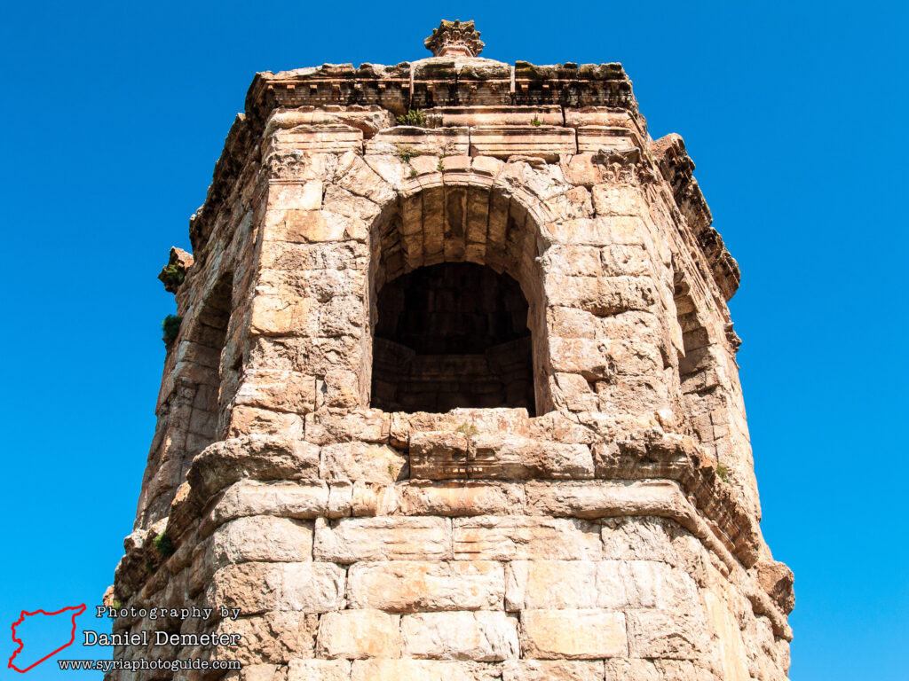
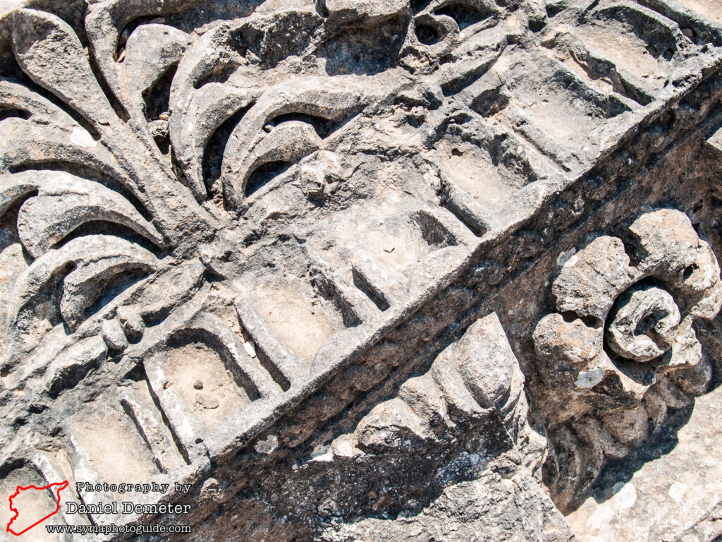
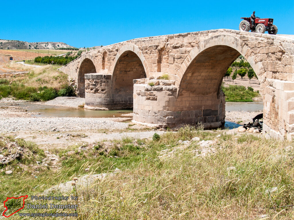
To the southwest of the site is an impressive hexagonal Roman tower tomb which is thought to date to the second or third century AD. The upper story is formed by a six-sided pyramidal roof supported by arches sitting on marble monolith pillars ending in Corinthian capitals. In the 14th century the lower floor of the tomb was converted as the burial place of a legendary Muslim saint, al-Nabi Houri, from which the site takes its modern Arabic name. The neighboring mosque was then constructed to accommodate pilgrimage to the site, which continues today. To the east, in the direction of the modern town of Aazaz (أعزاز), two second century bridges are also worth inspecting. They are still in use today, paying tribute to the incredible engineering skills of the Roman Empire. The first bridge is located about one kilometer from al-Nabi Houri (النبي هوري), the second an additional kilometer further. They are both about five meters wide, the western bridge utilizing six smaller arches and the eastern bridge three larger arches to cross the Afrin River.
Getting There: Reaching al-Nabi Houri (النبي هوري) using public transportation poses a significant challenge, and ultimately will require some combination of hitchhiking and/or hiring a private driver. There are two routes for approaching the site from the south, either from the village of Kafr Janeh (كفر جنة) on the road to Afrin (عفرين), or via the town of Aazaz (أعزاز). There are regular microbuses from Aleppo (حلب) to both towns.
From Aazaz (أعزاز), about twenty-four kilometers remain to reach al-Nabi Houri (النبي هوري) to the north. Infrequent public transportation from Aazaz (أعزاز) to surrounding villages could get you closer, ideally to the village of Deir Sawan (دير صوان). This would still leave over five kilometers to travel to the site, and hiring a private driver or hitchhiking would be the only option. Traveling this route would take you over the Roman bridges as you approach al-Nabi Houri (النبي هوري).
Alternatively, frequent microbuses from Aleppo (حلب) to Afrin (عفرين) pass by the crossroad village of Kafr Janeh (كفر جنة). From here, drivers ferry passengers to the villages to the northwest, around Midanki Lake. It is about thirty-two kilometers from Kafr Janeh (كفر جنة) to al-Nabi Houri (النبي هوري). Rates of private drivers here tend to be fairly reasonable, however, and you may find local passengers willing to share in travel expenses. It may be most convenient to hire a private driver from Kafr Janeh (كفر جنة) to al-Nabi Houri (النبي هوري) to arrive at the site early, and then return to Aleppo (حلب) via Deir Sawan (دير صوان) and Aazaz (أعزاز) in the afternoon. Note that the route via Kafr Janeh (كفر جنة) travels through predominantly Kurdish areas, while the route via Aazaz (أعزاز) is through predominantly Arab regions.
Coordinates: 36°44’39.07″N / 36°57’32.90″E
Transliteration Variants: al-Nabi Huri
Rating: 7 / 10